Geospatial Technologies
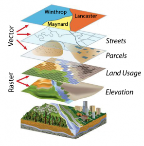
 TBirdie Consulting specializes in the use of geospatial information technologies (GIS) to optimize data for applications in the environmental, engineering, and energy industries. We create custom GIS applications to meet specific needs of users which greatly increase productivity by minimizing repetitive tasks and automating execution of complex tasks. We achieve this through our expertise in ArcObjects programming. ArcObjects is the technologic framework on which ArcGIS is built. It consists of a collection of software components with GIS functionality and programmable interfaces. These geospatial apps integrate backend infrastructure technologies, content management, and modern visualization techniques resulting in a relevant presentation of large and complex data without overwhelming the user and assisting in decision-making. Our team is also experienced in developing GIS solutions for regulatory compliance related to federal air emissions, hazardous waste disposal, and groundwater management.
Whether your application involves extensive spatial analysis, geocoding, or data mining among other tasks, we can build highly efficient customized solutions for better decision making, data analysis and interpretation, visualization, and map presentation in the following areas:
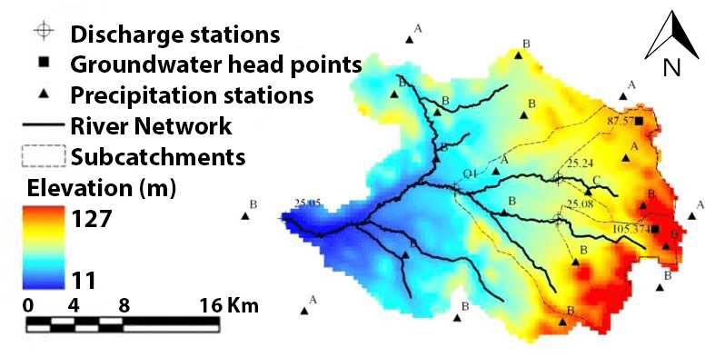
- Hydraulic and Hydrology Mapping and Analysis
- Environmental Analysis and Regulatory Compliance
- Economic Modeling for Return on Investment Analysis
- Transportation Mapping and Analysis
- Scientific Visualization
- Infrastructure Mapping and Analysis
- Business Analytics
- LIDAR Mapping and Analysis
- 3D Mapping and Modeling